The term of the Russian North unites following regions located in the north of the Russian Federation European part: St. Petersburg, the Leningrad Region (St. Petersburg and the Lenigrad Region are distinguished to the separate part of our web site), the Arkhangelsk Region including Nenets Autonomous District, the Murmansk Region, the Vologda Region, Komi Republic and the Republic of Karelia. Vast area of the Russian North borders in the south on regions of the Russian north-west (the Pskov and the Veliky Novgorod Regions) and central part of Russia (the Tver, the Yaroslavl, the Kostroma, the Kirov Regions) and also on the Urals (the Perm Territory), in the West – on Finland and Norway, in the east – on the West Siberia (Yamalo-Nenets Autonomous District and Khanty-Mansi Autonomous District — Yugra), in the north it is washed with the White Sea and the Barents Sea. In XIII-XV cc. all these vast territories were a part of Russian merchant the Novgorod Republic («His Majesty (or Sovereign) Lord Novgorod the Great»). In 1478 the Novgorod Republic was routed by the Moscow Principality and all territories of Novgorod were included into the Moscow state.

Huge dimensions of the Russian North stipulate for climate contrasts in its different parts: from Arctic and subarctic climate in the Arkhangelsk and the Murmansk Regions and Nenets Autonomous District to the continental climate in Vologda Region and Komi Republic. Karelia is located in zone of transitional climate from the marine to the continental. The average temperature is: in Arkhangelsk -25°C in January, +17°C in July; in Murmansk -10°C in January, +10°C in July; in Karelia -10°C in January, +16°C in July; in Vologda -10°C in January, +23°C in July, in Syktyvkar (capital of Komi Republic) -17C° in January, +16°C in July. There is a lot of rivers, lakes and swamps. The relief of most part of the region is hilly plain covered with mixed forests, taiga, forest-tundra and tundra. Relief in Karelia was largely formed at the Ice Age. That’s why hilly plain with a lot of morainic ridges and morainal lakes (there are about 60,000 lakes in Karelia including two largest in Europe lakes – the Lake Onega and the Lake Ladoga) is the main type of relief there.
In the mid-XIII c. lands located between the White Sea in the East and the Baltic Sea in the West were divided by the Novgorod Republic and Sweden (territories of modern Finland became a part of Sweden and territory of modern Republic of Karelia became a part of the Novgorod state). Since this period development of Finno-Ugric population of these lands went by separate ways. City of Petrozavodsk, the capital of Republic of Karelia, was founded in 1703 according to Peter I order when cannon-moulting plant was built on the shore of the Lake Onega during the Great Northern War (1700-1721) of European states coalition against Sweden. In the end of XVIII c. Petrozavodsk became a regional center of the Russian Empire. In 1809-1917 territory of modern Finland was a part of Russian Empire too as an autonomous Grand Duchy (Russian emperor has a title of Grand Duke of Finland). Educated part of the Grand Duchy population had keeping West European cultural tradition laid in Swedish period but majority of Finno-Ugric people both of Karelia and of autonomous Finland still had common cultural background. This is a fact that the most interesting songs of the Kalevala were collected by Finnish philologist Elias Lönnrot in Russian Karelia.
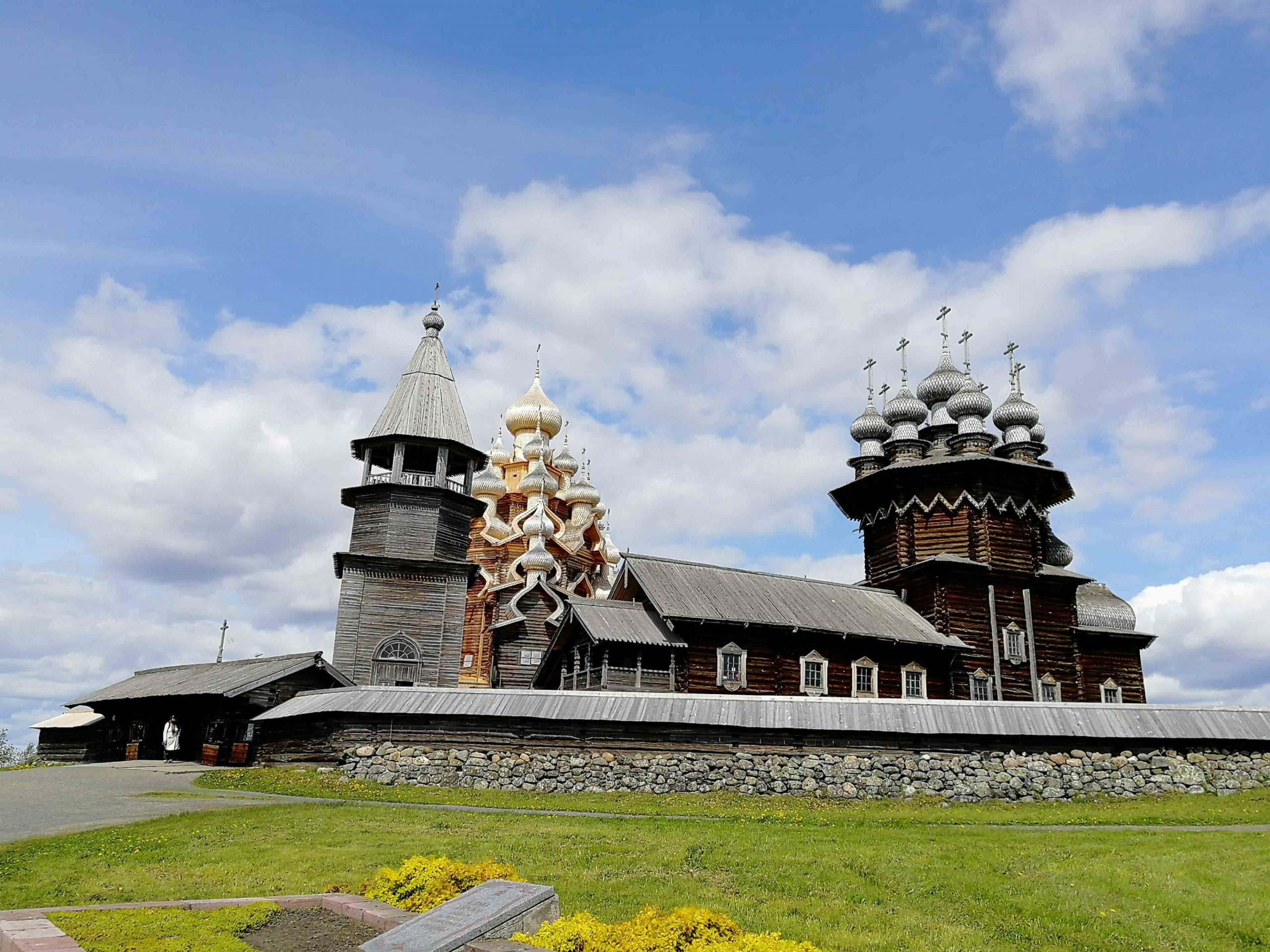
Fantastic virgin nature is the main tourist attraction of Karelia which is very popular destination for different kinds of summer and winter activities: rafting, trekking, biking, jeeping, cross-country skiing, tours by snow mobiles, ATV and hover crafts. Besides there is a lot of cultural and historical places of interest in Karelia. The most known of them is Kizhi – magnificent sample of Russian wooden architecture located at the island on the Lake Onega. Other very interesting places recommended to be visited in Karelia are the Valaam Monastery located at the scarrys archipelago at the Lake Ladoga, the first in Russia spa resort Martsialnye Waters opened in 1719 according to Peter I order, picturesque the Kivach Waterfall.
Everybody knows that tsar Peter I (the Great) opened a window to Europe for Russia when he captured Swedish lands on the Baltic Sea east coast as the result of the Great Northern War (1700-1721). Before that the White Sea was the only possible direct way from Europe to Russia. In 1553 ship sent by the king Edward VI of England for search of the way to China and India through the Arctic Ocean reached the south coast of the White Sea not far from the Northern Dvina River mouth. English captain Richard Chancellor was personally received in Moscow by tsar Ivan IV (the Terrible) who was glad to find detour but direct trade routes to Europe in bypass of hostile Sweden and Lithuania. Accordingly to the decree of the Ivan IV guest inns for merchants (the Gostinny Dvor), fortress and a sea wharf were built at the mouth of the Northern Dvina River (1584) where the Monastery of Archangel Michael was located since XII c..
In the XVI-XVII the city of Arkhangelsk was the only sea port of Russia. Peter the Great visited this city several times. Here he built the first Russian trade vessel and introduced the Russian national flag (state flag of Russia now) designed specially for Russian trade fleet (1694). Arkhangelsk Region is the motherland of Michael Lomonosov, the prominent Russian scientist and poet, founder of the first Russian university in Moscow (1755). During allied intervention in the Russian Civil War Arkhangelsk and Murmansk were occupied with British, USA and French troops (1918-1919). In period of WW II Arkhangelsk and Murmansk became the destination point for the Arctic convoys (1941-1945).

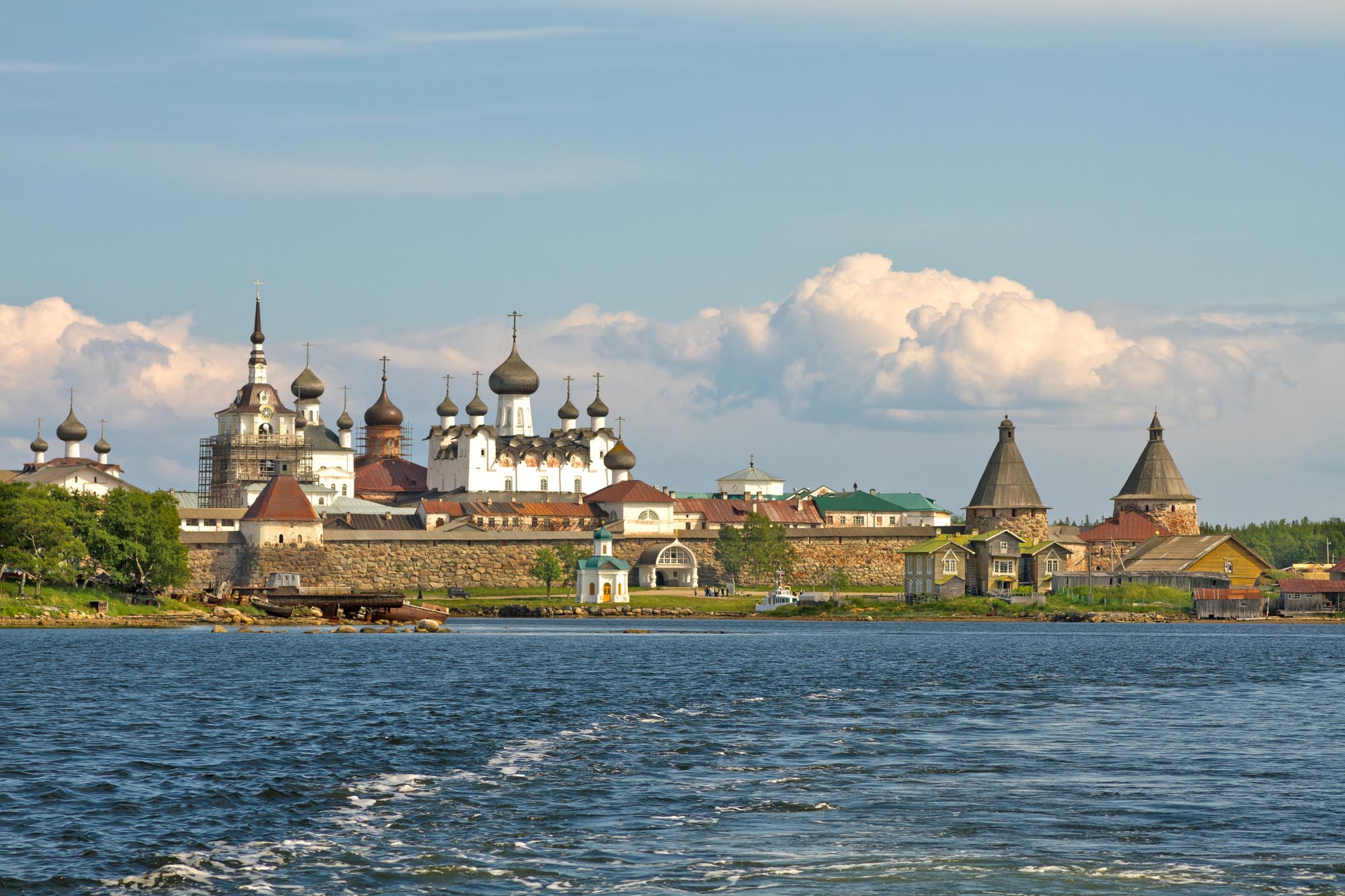
At Kholmogory village located not far from Arkhangelsk you will be acquainted with unique hand craft of bone engraving. At the Arkhangelsk Region you have a chance to visit original camp of reindeer herders. The Solovetsky Archipelago (often called just the Solovki) at the White See with famous monastery of XV c. known for its unique architectural complex and also for its tragic history in period of Stalin’s Gulag is also administratively included to the structure of the Arkhangelsk Region.

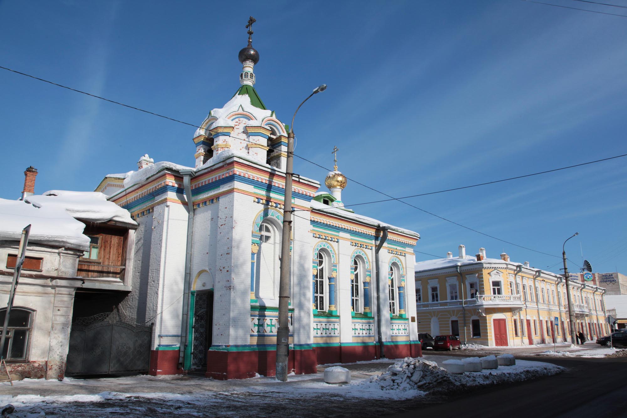
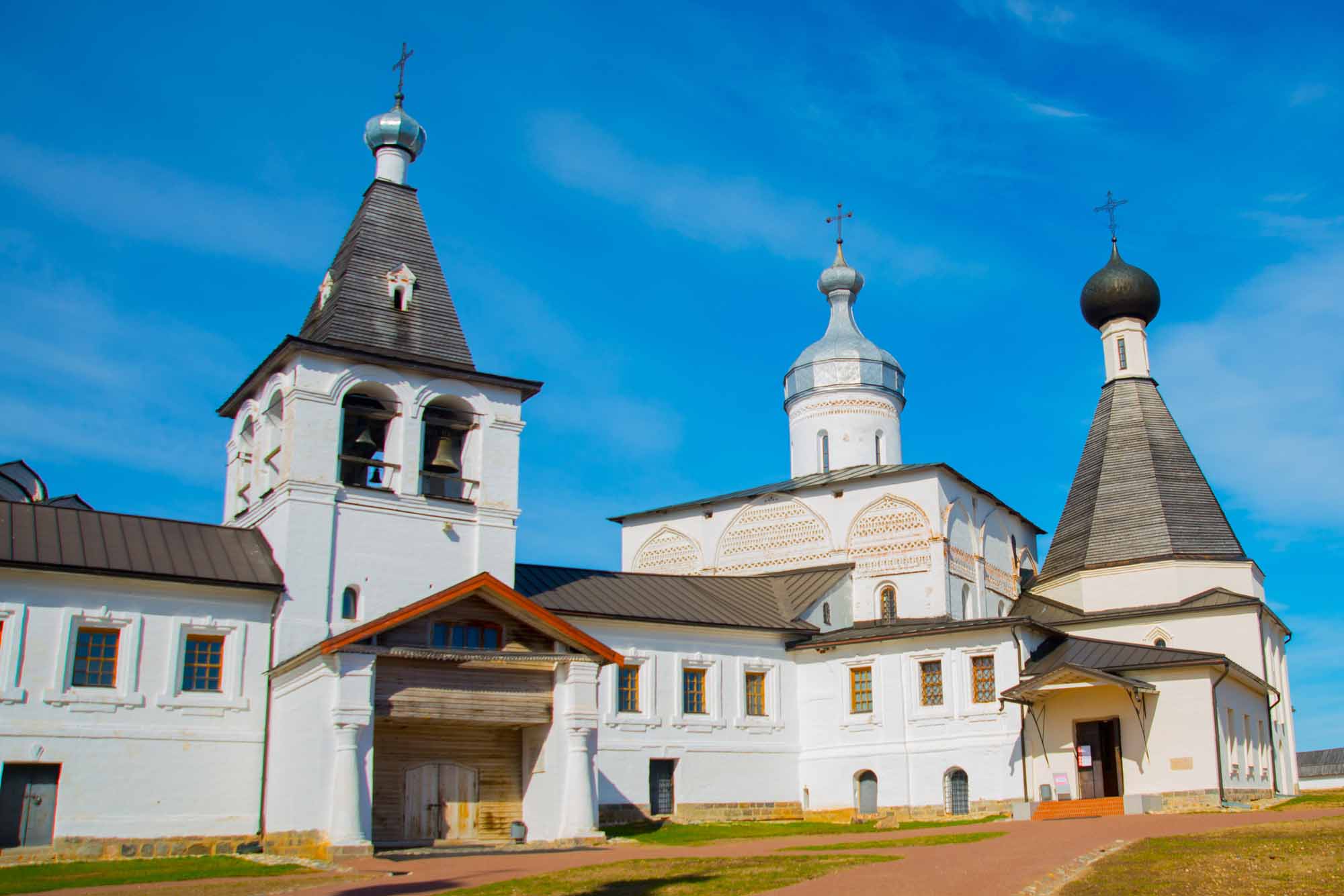
In the Middle Age this ancient Russian town (the first time Vologda was mentioned in chronicles in 1147) located in the crossing of trading water ways was an object of very long struggle between the Novgorod Republic, the Moscow and the Tver Principalities. Two ancient monasteries founded in the late XIV c. are located not far from Vologda: the White Lake st. Cyril’s Monastery and St. Therapontus Convent included to the UNESCO World Heritage List.
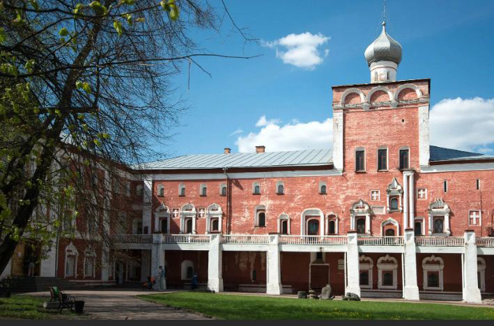
During the reign of Ivan IV (the Terrible) Vologda became the most important transit point for trade between Russia and Europe countries through the White Sea and the Northern Dvina River way discovered by English captain Richard Chancellor. English business office was established in Vologda and the Sovereign’s Storage Yard was arranged there accordingly to the order of Ivan IV. In period of the Oprichnina terror (1565-1572) manically suspicious tsar Ivan IV had serious plans to move his residence to this remote place from Alexandrov located not too far from Moscow and building of the big fortress started in Vologda but this project was stopped soon when the Oprichnina was abolished.
During the reign of Peter I (the Great) Vologda was large military base and shipbuilding center (the Museum is arranged in the house of Dutch merchant where Peter I stayed during his visits to Vologda) but moving of the Russian foreign trade to the Baltic Sea led to the decline of Vologda in the XVIII c.. Construction of the Mariinskaya Water System in the mid-XIX c. and and railways in the late XIX c. revived Vologda again. Local butter and laces became the world brands. Since XV c. Vologda was a place of political exile called Near Siberia. In the XIX – early XX cc. Vologda was visited by representatives of practically all anti-tsarists movements: philosopher, one of the main theorists of narodism Pyotr Lavrov, Bolsheviks Josef Stalin, Vyacheslav Molotov, Maria Ulianova (Lenin’s sister), Anatoly Lunacharsky, Socialist Revolutionary Boris Savinkov, left-wing philosophers Nikolai Berdyaev and Alexander Bogdanov, writers Vladimir Korolenko and Alexei Remizov.
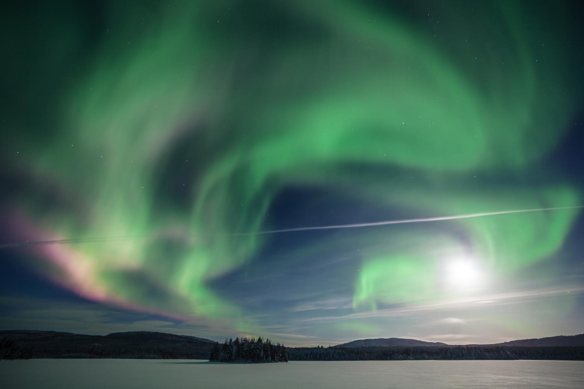
The Murmansk Region of Russia situated on the Kola Peninsula is the east part of Lapland. The main part of the Murmansk Region is located in the polar circle so this land is an actual Arctic where you can see original tundra and where you gave a chance to watch original northern lights (Aurora Borealis). Polar Night sets in on December 1 and lasts more than 6 weeks. The Sun appears in the sky on January 13. Polar Day sets in on May 23 and continues till July 12. During these days the Sun never sets down.
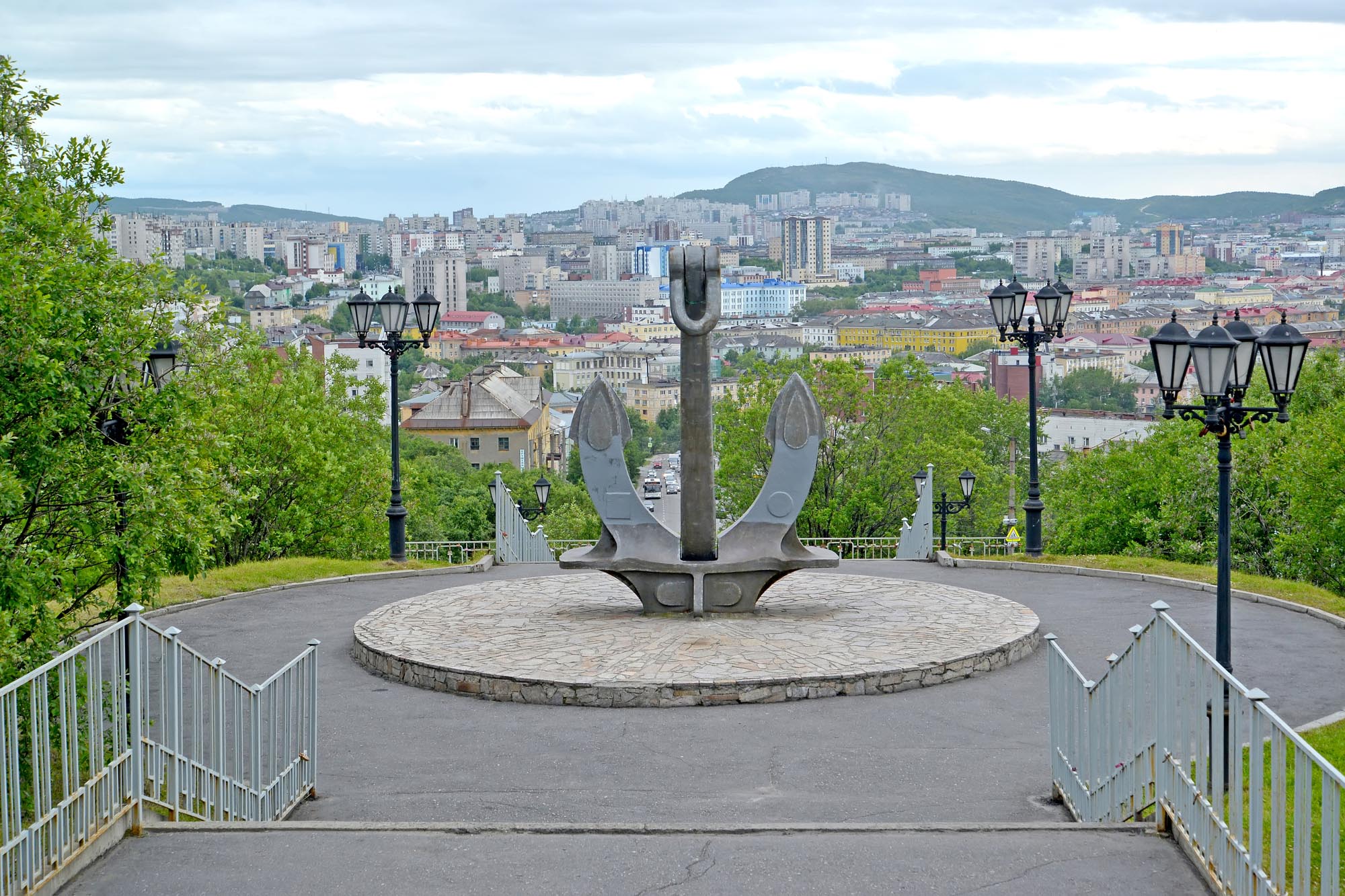
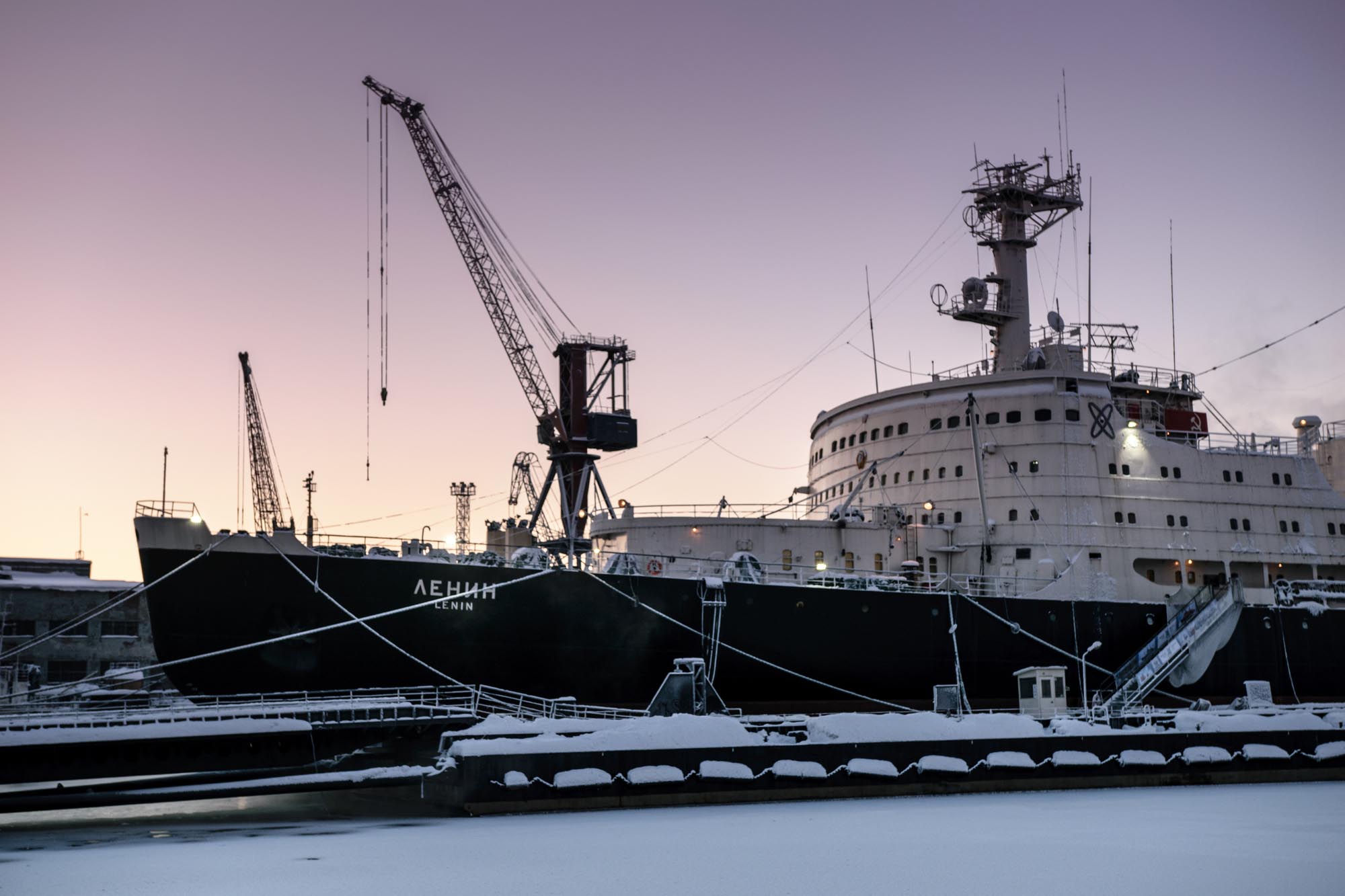
In the Middle Ages this region was a part of the Novgorod Republic. Then it became a part of Moscow state. Development of the region started in early XX c.. The defeat in the Russo-Japanese War (1904-1905) was largely due to the fact that Russia couldn’t transfer its Navy from the Baltic Sea to the Far East rapidly. That’s why Russian government adopted decision to create the Navy in the Arctic and to search water way to the Far East through the Arctic Ocean. The city of Murmansk was founded in 1916. Search of the Northeast Passage from European part of Russia to the Russian Far East was actively continued in Soviet period. Murmansk became the greatest sea port in the North of Russia, base of its ice-beaker fleet and its Arctic gates.
During allied intervention in the Russian Civil War Arkhangelsk and Murmansk were occupied with British, USA and French troops (1918-1919). In 1920s-1930s thanks to efforts of academician Alexander Fersman great alkaline massifs of the Kola Peninsula were discovered. The peninsula was covered with numerous camps of Stalin’s Gulag and soon the region became one of the largest in the world producers of a wide range of industrially valuable minerals. In period of WW II Arkhangelsk and Murmansk became the destination point for the Arctic convoys (1941-1945).
Dikson is rocky island located at the Kara Sea of the Arctic Ocean not far from the Eastern coast of the Taimyr Peninsula. The local settlement and its sea port, the top northern port in Russia, is very important point at the Northeast Passage connecting European part of Russia with Russian Far East. This very suitable bay was known for Arctic navigators since the XVIII c. or even since XVII c. but its present name the Dikson received in 1875 only when outstanding Swedish navigator Adolf Erik Nordenskiöld named this bay in the honor of industrialist baron Oscar Dickson who helped Nordenskiöld to arrange his expedition. Since 1901 the Dikson Bay was used by Russian Arctic expeditions for keeping of coal supply. In 1915-1916 radio station and hydrometeorological station were arranged here. In different periods Dikson was visited by Eduard Gustav von Toll, Fridtjof Nansen, Roald Amundsen, Ivan Papanin and other well-known polar explorers. During the WW II in August 1942 German cruiser Admiral Scheer tried to destroy port, radio station and hydrometeorological station at the Dikson Island but small Red Army garrison successfully repulsed an attack.


